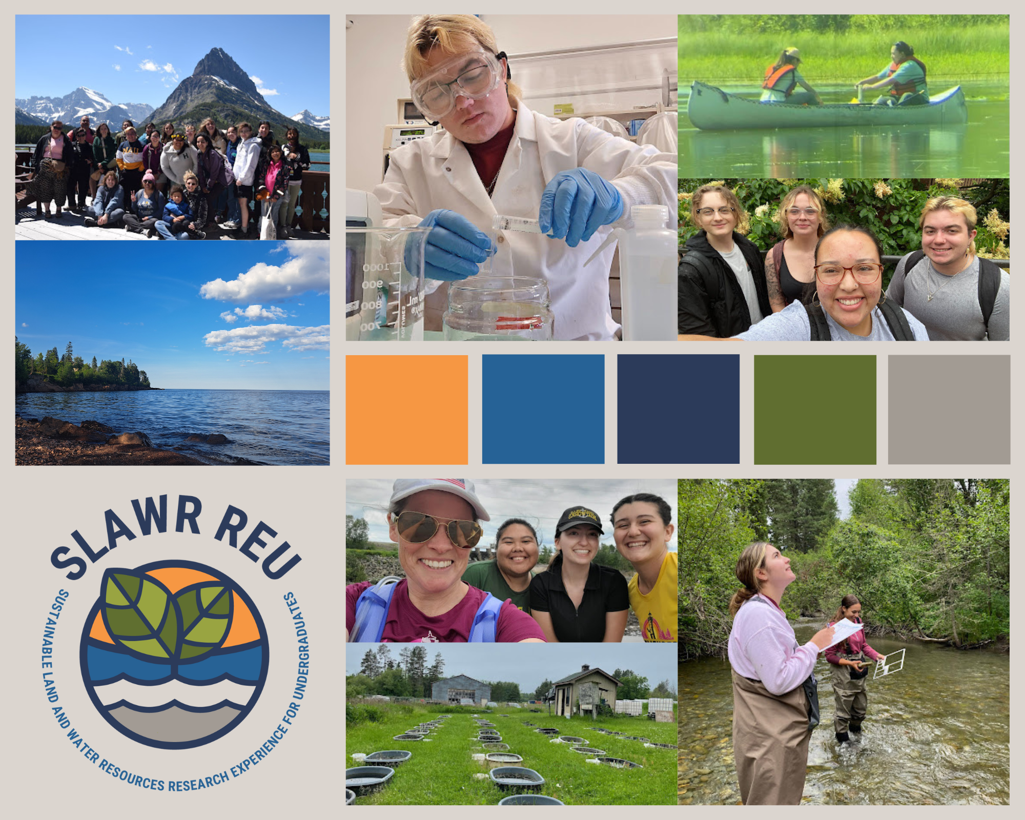
SPAW Team Update: noah, logan, erin, phil – JUNE 27-JULY 3

SPAW Team logo 2022

The SPAW is proud to announce this year’s team logo. The logo represents each of the team member’s projects. Although each project is distinct, they are all unified under the topic of the SLAWR REU. Top left to bottom right; Erin’s research on wetlands, Noah’s research on evapotransportation, Logan’s research on Yellow-billed Cuckoos, and lastly Phil’s research on lake wind currents.

This past week the SPAW Team has been hard at work conducting fieldwork and collecting data. Although, Phil and Noah’s research does not require fieldwork, each will pair off with Logan and Erin to aid in their projects’ fieldwork. Phil and Erin went out to collect core samples from wetlands, while Noah and Logan began ground-truthing and bird calling for the Yellow-billed Cuckoo. Despite the long hours of fieldwork this past week the SPAW Team was able to take some time and hang out together enjoying the Montana weather. They flew Noah’s drone and took TEAM SPAW pictures and had fun taking videos.

SPAW Team having some fun.

Week 3 at the Johnson Lab

This week involved analyzing the data from the UMD farm from the previous week. Vials of surface water in the rice tanks and ‘peeper’ water that was soaked in the plants’ roots were all measured. Weight, pH, and changes in color were all recorded. This was good experience for me to learn laboratory skills in sampling and recording.

At the farm, our team measured plant count in the many wild rice tanks. These are controlled for sulfate by measured sulfate being pumped into the surface water of tanks. Bacteria that typically coexist with wild rice also live in the tanks; they fix the sulfate into sulfide which permeates into the water and is lethal to wild rice.

Peeper Collection – Amber Simon

This week the Duluth team collected peepers from the mesocosms and extracted the water from the wells to test sulfate and iron concentration along with the pH. The data was taken to the lab where we checked the absorbance of the iron and sulfate and calculated how much sulfate needs to be added to the mesocosms.

To the left is the team collecting the water from the wells of the peeper to test sulfate and iron concentrations. The middle picture is the peeper with four wells. Each well had porewater that needed to be tested. The right picture is the mesocosm which holds a controlled system for the wild rice plants.

Team Stream Urban Nature Group – Learning new skills!

This week I got to learn some new skills and tools! I went to Bruce Vento Nature Preserve (also known as Wakan Tipi) with some other members of my lab. Katie Hoffman, the Laboratory Manager, taught me how to use a Hach Portable Dissolved Oxygen and Conductivity probe meter for taking water quality data. I also learned how to filter water samples for carbon, nitrogen, hydrogen, chlorophyll a, and particulate phosphorus in the lab. I think these skills will be useful when trying to measure the health of aquatic ecosystems!

SPAW-ers: phil, noah, logan, erinbell – 20-26 JUNE

This week we accompanied researcher Rebekah Brassfield, aiding her with bumble bee work. We observed fly-bys, and flower visitation by bumblebees, as well as noting wind, humidity, temperature, and flower species abundance.

Her field sites are on tribal land, stewarded by Confederated Salish + Kootenai Tribes, filled with beautiful wildflowers and wide views of this valley, about 3,600 ft elevation.
Her sites are located in the trails above Jette – a housing development that moved from tribal homelands, into “owned” allotments, via the Dawes General Allotment Act (1887), followed by the Flathead Allotment Act (1904). This moved tribal land into settler ownership, effectively, “breaking up of communal tribal homelands and setting a course for catastrophic land loss on reservations.”

Meanwhile,
Noah found that his research question regarding evapotransportation rates correlated with wind has essentially been answered already. He deftly pivoted, now working on climate change effects correlated with evapotransportation.

Philip has been developing his R skills, as well as analyzing wind data. His work is moving along smoothly, investigating relationships between wind and lake shore erosion in the [East Side/Finley Point/Finley’s Armpit].

Logan continues his work, analyzing GIS layers, working towards building a habitat suitability model for Yellow-billed Cuckoo. He anticipates going to groundtruth with one of our mentors, this Friday. He is concerned about the complexity of the modeling in his research.

erinbell has been hanging on the edge of her seat, waiting to hear when and where she will be able to gather soil sampling for her project with wetlands and carbon sequestration. She remains excited, and has just found that she will be able to do her first field day this Friday.

Also, we had a bbq and it was sooooooo nice!


Yakima Valley Arboretum-Darren Olney

Image

REU Sustainable Water and Land Resources

Monday training activity with group

Scott Alexander and Peter Kang showed us the bailing sampling and slug test method. Is a particular type of aquifer test where water is quickly added or removed from a groundwater well.

Same day as aquifer testing we did a lab safety course with Scott, lab supervisor
(WAM)-Weisman Art Museum-Artist B.O.J. Nordfeldt

SLAWR REU Orientation post

Hello everyone! Kinda nervous but also kinda excited about this summer. I have only participated in one REU in the past but for the most part it was field work and less on facilitating research. Coming from a 2-year institution this is gonna be a great opportunity to get my feet wet as far as doing research goes. Good luck y’all. Here’s a little picture of my doge Pubbish.

2021 Communication and Team Facilitation Intern Yusuf Khairulhuda creates a 2021 All-Team Story Map

Yusuf Khairulhuda, a University of Minnesota student majoring in Product Design/User Experience was an IonE Sustainability Intern for the 2021 REU on Sustainable Land and Water Resources. Besides his work providing our participants with a great experience this summer, Yusuf created this story map about the REU SLAWR 2021.

REU SLAWR 2021 created by Yusuf Khairulhuda

Yusuf giving kudos to Michelle and Jackie on their poster at the All-Team Symposium.

Team Zaaga’igan Job Shadowing at Fond Du Lac DNR

For the past two weeks my partner Jackie and I have been doing job shadowing at FDL natural resources dept. We did a variety of activities which included hunting for invasive snails, aquatic vegetation surveys, electro shock fishing, visiting a local abandoned wolf den, and also visiting their manoomin lakes. It is very inspiring how the tribe uses their tribal sovereignty to the fullest extent by creating their own water quality standards, caring for not only their lands but also their treaty territories in the area. We got to hear the stories from many of the FDL staff and why they’re invested in caring for the land. This experienced has peaked both of our interests in working for tribal DNR in the future.

Manoomin lake on the Fond Du Lac reservation

Team Zaaga’igan: Peeper Week!


Peeper extraction setup: white sanitary table covering, blue pH meter up front, deionized water containers, Kimwipes and gloves for sanitation, prepared vials with blue labels, nitrogen filled vacuum bag at back, data sheets, red needle tip disposal bin, and secured black nitrogen tank with a tube running to the bag. Photo at University of Minnesota Duluth Research & Field Studies Center.

Last week’s post described what peepers are used for and what this week will involve. After a team meeting Monday, we decided we were ready to start that morning! We decided to finish five peepers that day, which would mean getting pore water samples into about 80 vials for various measurements; each peeper needs about 16 vials: pH, Iron, and sulfide/sulfate vials for each of the four peeper wells, two composite vials, and two for surface water measurements. The pH is measured immediately and the rest are analyzed at the lab.

Before getting a peeper for sample collection, we began by pipetting the appropriate proportions of acids and reagents into the vials so everything would be ready for the pore water samples. It is important to do everything we can in advance, since this is a time-sensitive process and the pore water samples can be contaminated by the higher concentration of oxygen in the air. We weigh the vials before and after adding sample.

The process of getting pore water from a peeper involves multiple moving parts. Samples are drawn into a syringe in a low-oxygen environment created using a vacuum bag (typically used for storing linens in a smaller space) and stream of nitrogen gas. We start with the most reduced well, number four, that was deepest in the water-saturated ground and work up to the first well. This is because the wells will be more exposed to oxygen closer to the surface and we do not want to risk any contamination. We put appropriate measurements of sample into each prepared vial for separate peeper wells, test the pH, gather surface water samples, and make the composite samples. To do this efficiently we had about five people with their own task to speed the process along.

After each day of sample gathering, the completed samples are analyzed at the lab. Michelle and I helped measure the absorbance of sulfide and Iron on the spectrophotometer. This is done using a tall cuvette that we zero with deionized water then fill with sample and quickly get the absorbance back as a decimal.

Spectrophotometer in Nathan Johnson’s research lab in Voss Kovach Hall at The University of Minnesota Duluth: absorbance measured for sulfide from one of the individual peeper well sample vials. Cuvette used seen centered between the spectrophotometer, vials, and data pages.

The life of a virtual REU student

Zanti Rains

My project is on the erosion of the wetlands at Finley Point on Flathead Lake in Montana. It involves Kerr Dam, which is causing the majority of the erosion, and it involves a request by a community member to build a dock right through Finley Point. This summer, I am researching the issues going on at Finley Point all behind my computer.

Being a virtual undergraduate researcher consists of long hours of studying scientific papers and articles and taking organized notes. It also consists of Zoom and learning programs like StoryMaps and GIS Mapping. My mentor, Peter Gillard, is the GIS program manager with the Confederated Salish and Kootenai Tribes. He has been a big help in getting started and finding resources. I’ve learned a ton about my project and programs to tell the story I’m learning, and I’ve had a lot of fun doing so. Although I’ve been enjoying my research, it has been a challenge taking on this project remotely and I’ve had a hard time finding my voice.

Recently, I realized my purpose and I feel back on track. This summer, I will act as a translator from a plethora of scientific research and history to the community. I understand now that in the field of science, community outreach is needed just as much as research itself. If no one knows that wetlands are important and they’re being degraded, how can we expect policymakers and community members to take action? To address this issue, the community needs an accessible, thorough, and inspiring story to learn about what is going on and how they can help. That is my purpose this summer: to tell the story of the environmentally and culturally important wetlands at Finley Point to inform and inspire the community.

Team Zaaga’igan: What is a Peeper?


Photo example of a peeper from a team email sent by Nathan Johnson.

To the left is a larger version of the peepers placed in many of the wild rice mesocosms at the University of Minnesota Duluth Research and Field Studies Center. The peepers we will be working with have about four wells (the thin rectangles you see) that take in ground water from different depths. This is done by diffusion: distilled water placed in the peepers is replaced by water from the soil. We can then measure for Metals, Iron, Sulfide, Sulfate, and pH at different depths in each tank.

This week, with the team, we are prepping for Peeper week, which involves preparing and labeling about 430 bottles that will hold groundwater samples for analysis. Monday morning, we began helping to write out labels for each individual bottle. Later in the week, we helped to pack all the gear for analyzing groundwater from the peepers, including a pH meter, syringes to draw out the samples, nitrogen bags to keep an low-oxygen environment while drawing samples, and many other supplies. The low-oxygen environment is vital to avoid contaminating the groundwater, since there is a higher concentration of oxygen in the air than in the soil. We will be starting the excitement of peeper week this Tuesday or Wednesday after ensuring everything is ready to go.

Photo example of labels to be placed on all of the groundwater sample bottles. Each label lists the project name, mesocosm number, peeper number, peeper well number, the expected date, and what to measure.

Mesocosms at the University of MN Duluth Research & Field Studies Center.

Lab work at Nathan Johnson’s research lab in Voss Kovach Hall at the University of MN Duluth.

Team Stream – Bdote

Measuring seedling growth and survival in a transition plot on June 16th at Crosby Farms.

This week was the first week in the field for Team Stream down at Crosby Farms. We are part of the Adaptive Silviculture for Climate Change (ASCC) project and are currently monitoring seedling growth and survival rate of trees planted last year. The ASCC project focuses on implementing three tactics to better propose new forest management techniques for the future under a changing climate: resistance, resilience, and transition. Resistance refers to keeping current forest conditions the same but helping the forest defend itself against a warming climate. This entails planting more native vegetation. Resilience refers to creating an “elastic” environment where forests gain the potential of rebounding back from changes. For example, introduce more flood or drought tolerant species. Transition refers to changing the vegetation to promote growth. This also entails introducing more flood or drought tolerant species but from climates slightly warmer than those introduced in the resilience plots.

We are also working on building individual research projects. Cully plans on analyzing water movement through trees and I, Claire, plan on researching the impact of the microtopography on soil moisture and soil organic carbon contents.

Team Zaaga’igan: How our research is going

This week was focused on gathering water samples from mesocosms containing wild rice and varying levels of sulfur and leaf litter for carbon. The goal is to maintain constant levels of these variables in order to study the affects of mining on wild rice. To keep up the levels of sulfur, water samples from each tank are placed in a spectrophotometer to measure the concentration of sulfur. The measured concentration is subtracted from the goal concentration in order to tell how many grams of sulfur to add to the tanks.

Mesocosms at the University of MN Duluth Research & Field Studies Center.

Lab work at Nathan Johnson’s research lab in Voss Kovach Hall at the University of MN Duluth.

First field day for Team SPAW

Our view of Flathead lake from the road

The local Montana team members of SPAW (Rebekah Brassfield, Antawnna Berthelote, and myself, Aspen Jaeger) went out for the first time on Wednesday, June 16th. We were planning on going to a lower elevation site to conduct a bee capture but unfortunately had to change plans when a very large tree decided to take a nap on the road. We instead went to another higher elevation site, where we took a quick inventory of what was flowering. It was a little too chilly to do a bee capture or Antawnna’s salinity research so we spent the time walking along the road talking about the REU and research project ideas for myself. The drive there and back was beautiful and I managed to snap this picture on the way back down.

the photos above are from our field site

Chris in the Lab

Chris is creating an vacuum chamber for working with oxygen sensitive materials. In reality, he’s holding a Kleenex box. The chamber uses nitrogen to ensure there’s no oxygen in the chamber. Team Stream – manoomin – toured Cara Santelli’s lab in Snyder Hall at the Univ. of Minnesota. Snyder is where Team Stream prepared geo chemistry materials for their first field day on June, 14th 2021.

Find Paid Summer Research!

PathwaysToScience.org

Paid Summer Research Programs!

Most programs offer both a stipend and housing and travel support. Programs range across all STEM disciplines and all areas of the country! Deadlines are coming right up for most programs!

Postdoc and Graduate Student Opportunity

These postdoc and graduate student opportunities might be of interest. The postdoc position has a very flexible start date, and the candidate does not need to check all these boxes. It’s our “wish” list. 😊

Regards,

Morteza Karimzadeh, PhD
Assistant Professor, Department of Geography
Affiliate Assistant Professor, Computer Science, Information Science
University of Colorado Boulder
Traditional Territories of the Arapaho, Cheyenne and Ute Nations

Transdisciplinary Postdoctoral Research Associate Position in Spatial Data Science and Geoscience

University of Colorado Boulder, Boulder, CO

Starting date (very flexible): 1/7/2021

Application review begins December 7, 2020 on a rolling basis until the position is filled.

We invite applications for a postdoctoral research associate position at the Department of Geography, University of Colorado Boulder (CU Boulder), with a flexible starting date of 1/7/2021 and possibility for remote work, although the ability to work on the CU Boulder campus in the long term is desirable. The initial offer is for 12 months, with potential for renewal contingent upon favorable progress.

The postdoctoral scholar will primarily work on a recently funded NSF EarthCube project (Data Capabilities: Enabling Analysis of Heterogeneous, Multi-source Cryospheric Data, Award# 2026962) under the supervision of principal investigator, Dr. Morteza Karimzadeh. The project is focused on creating software systems and cyber-infrastructure for harmonizing heterogeneous big data products (including satellite imagery and in situ observations) in a cloud environment for various downstream tasks. The technologies developed are expected to be extendable to a variety of applications, but for this project, the focus will be on classification and mapping of sea ice.

Sea ice is an important component of the climate system and a key indicator of climate change. Sea ice is spatiotemporally dynamic, exhibiting a variety of evolving ice types that need classification for scientific analysis or operational planning. The mapping of sea ice at high spatial and temporal resolutions remains a scientific challenge. With the increasing availability of high-resolution remote sensing products such as SAR and lidar, there is a renewed desire for tackling this challenge. However, bridging data science and geoscience is key in successfully harnessing these large heterogeneous data for sea ice mapping.

The postdoctoral position will be homed in the Geography Department at CU Boulder and will actively collaborate with the co-PIs, scientists and students in the National Snow and Ice Data Center (NSIDC) and CU Denver’s Department of Computer Science.

The postdoc duties will include:

Design and implement software and computational modules in collaboration with the team’s sea ice scientists, remote sensing experts, and spatial data scientists.
Draft and lead scholarly publications and reports.
Assist the PI with leading research activities within the group and project management.
Assist the PI with user evaluations and stakeholder engagement at NSIDC, NOAA, NCAR, the U.S. National Ice Center (NIC) and the Canadian Ice Service (CIS).
Assist in supervising graduate and undergraduate students in the team.
Assist in drafting successful research grant proposals.
Interface with other research groups at and beyond the NSF EarthCube community and the University of Colorado.
Work with research assistants to prepare training and outreach material, including easy-to-use Jupyter notebooks for product adoption.
Given the transdisciplinary nature of this postdoctoral position, we expect that the candidate has foundation in either one or both spatial data science and/or geosciences, with the position strengthening the postdoc’s expertise in both disciplines.

The qualified candidate will possess a majority of the following, with interest in developing the rest:

A Ph.D. in geography, geoscience, computer science, information science, statistics, or a cognate field is mandatory.
Research background and expertise in applied machine learning and particularly, deep learning.
Background and experience working with, spatial data, geographic information systems and earth observations.
Familiarity with passive and active microwave imagery, airborne and spaceborne lidar altimetry is desirable (examples include SAR imagery from Sentinel-1, lidar altimetry data from Operation IceBridge, ICESat and ICESat-2, and radar altimetry data from CryoSat-2).
Programming skills in Python, Scikit-learn and deep learning libraries (TensorFlow, or Keras or PyTorch). Working ability with R and its spatial packages is a plus.
Interest or background in visual analytics for interactive machine learning is desirable.
Experience working with cloud storage and compute instances is desirable.
Experience in working with the output of climate models is desirable.
Front-end development and visualization skills using D3.js, leaflet.js and the React framework is desirable.
Excellent oral and written communication skills.

Both beginning and senior postdoctoral candidates are encouraged to apply. To apply, please upload your CV, a research statement (no more than one page) and the contact information of references to the application portal:

https://jobs.colorado.edu/jobs/JobDetail/Postdoctoral-Associate/27487

Please direct your questions to Dr. Morteza Karimzadeh (karimzadeh@colorado.edu). Applications will be reviewed on a rolling basis starting December 7, 2020 until the position is filled.

MS/PhD positions

Funded MSc/PhD positions are available in Dr. Morteza Karimzadeh’s research group at the Department of Geography, University of Colorado Boulder, starting Fall 2021. The application deadline is December 1, 2020. The positions are supported through TA and RA appointments.

The successful candidates will join a vibrant and growing team of graduate students and postdoctoral researchers. Our current spatial data science projects intersect with geovisual analytics, GeoAI and spatial statistics in a variety of domains including sea ice mapping and cryospheric data fusion, quantitative analysis of human mobility, geo-text analysis of various organizational and archival textual sources, and modeling spatial connectivity and dependence.

Details about the program can be found here. Please also note that we have a graduate application fee waiver for under-represented minority applicants and applicants with financial need.

For inquiries, please feel free to contact karimzadeh@colorado.edu with your CV, explaining how your research expertise or interests may align with the team, and what potential areas you’d be interested in working on in the future.

Progress on Model

Plot and information output from the code.

The model I am working on is built in python and simulates carbon nanotube networks. Previously, you would run them model, save the data to your computer, and put that data into Mathematica in order to plot the points and get the “m value” from plotting the points in a loglog plot. Recently, I was able to add this plot and m value into the python code itself to save some time and the need to run a second program.

Binder Park

There is a small lake just outside of city limits that I went to a couple weeks ago. I drove around and took some pictures but they are to big to be uploaded onto here. People can fish and go boating on the lake. There are camp grounds near the lake, but I’ve never camped there.

New Species!

Making hundreds of slides and going numb after inhaling glue for hours paid off! We were able to uncover many plant axes containing glomeromycotan fungi. Most of my work has been doing literature reviews and making comparison tables, and we believe our material represents a new species. Or if anything, a variation of a species already described. Either way, (new species or not) it is still amazing to recover 400 million year old fungal spores that are less than 100 micrometers. More knowledge on fossil fungi-plant interactions further supports the hypothesis that they evolved together.

Eshlan Cody Henrikson

Holding Red Sea Urchins at Patrick’s Point State Park

Yaghali’du, eshlan Cody Henrikson. Hello, my name is Cody Henrikson and I am of Dena’ina and Sugpiaq descent and an enrolled member of the Ninilchik Village Tribe of the Kenai peninsula in the great land of Alaska. I am a senior undergraduate at Humboldt State University double majoring in Marine Biology and Native American Studies with a focus in Indigenous Food Sovereignty. My passions for the ocean, my traditional foods, and tribe have led me to my professional goal of creating and managing marine aquaculture systems in his home state of Alaska. I hope that in doing so I can provide economic growth and stability, a source of food sovereignty, and research opportunities for my people, community, and all of Alaska. Naqantugheduł, the tide is coming in (good things are happening and you cannot stop it)

New Beginnings!

Jamie Colvin here and ready for this experience. I am so excited to get started this summer with all of the interns and mentors. I absolutely love field work when it comes to conducting research. I believe that is the best part of it all. Pictured is the Haskell Wakarusa Wetlands in Lawrence, KS. I had recently surveyed for important ecological factors that make-up this wetlands at Haskell Indian Nations University for my Aquatic Biology course I enrolled in for the Spring 2020 semester. I was focusing on Typha latifolia or commonly known as Broadleaf cattail. This was just at the beginning of spring, so the cattails were not fully formed just yet as you would normally envision one.

Study Buddy

Here’s a video of me (Tyler) and my buddy (Butter) but we just call her kitty. She was trying to help me out while I open the accessory kit for our GoPros and as you can tell in the video I was a little overwhelmed when opening it up! This video was taken with our GoPros.

Zoom REU

A few months back, it didn’t cross my mind that I’ll be participating in a virtual REU but here we are making the most of it. The students, mentors and my team STREAM all are amazing and I can’t wait for more learning and deepening our friendships.

Hole in the Rock

First week adventures

Week 7

Finished processing the available grids and almost completed my paper. Cool thing is that in the first grid several unmarked graves were found. More will be said on that in my paper and on my poster. Worked on my tiny house some as well. We got the lofts in, the house wrapped, and most of the roof on. Cant wait for the shell to be complete to start working on the inside. This internship is challenging in a way because I have had to learn to balance my family life with what was required of me in my research.

Last sprint to the finish line

On the road to Grand Portage for a MNTEC meeting

The summer has gone by so fast. As it stands, there is one week til my paper is due and two weeks til I head home. Time really flew by and now I just realised how long its been since I posted. So much for a week by week recap lol, but I thought I’d put up some of my pictures (not that I took that many). I went with some of the project leads on a trip up north. We went to Ely then Boise Forte and then Grand Portage. The drive to Grand Portage was the best part because it was all along the North Shore on Lake Superior. Definitely a dejavu moment because of how similar it felt to drives along the Lake Michigan on the way to Petoskey.

I’m sitting in a cafe downtown right now, still working but getting closer to that ideal word count. This Wednesday we were at the Sandy Lake Memorial where Andrea and I canoed across the lake. We also had a preliminary poster presentation with our pals from Duluth and GLIFWC interns. It was good practice on talking about my project. Anyways, it was just a good time with the other interns and I can definitely say that I will miss the friends I have made this summer. So here’s to the next two weeks with these girls.

All of us were stuffed after the vegan food festival

In the Montana Heat

The temperature has been slowly creeping up the thermometer making the field days uncomfortable. Luckily for me my project is just a lot of reading and calculations that I can do inside away from the heat. As it so happens my desk at home is in front of the AC making for a very enjoyable work area. It is has been very interesting reading about the cultural importance of huckleberries to the Native American tribes. For the most part huckleberry harvest was a time for seeing friends and family as they travel to their harvest locations. They would pick during the day and celebrate during the evening. It sounds like a wonderful time.

We joked about us all getting a bumble bee tattoo at the beginning of the internship. As I already had plans for a sleeve and the bee just so happened to fit into my design I took a break to visit a friend. My friend opened a tattoo parlor here in Polson over a year ago and is doing some nice work. it was nice catching up and getting started on my sleeve.